QSL card
Please confirm radio contacts, receivings or beacons only direct
|
- by post (see below: Confirm QSL) - by e-mail: pd2ew (at) yahoo.com - by e-QSL.cc - pse no buro |
|
Confirm QSL: for home QTH
|
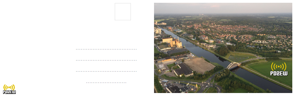
Erik Wijkamp Zwiepseweg 41 7241GN Lochem The Netherlands (Holland) |
Latitude: 52.157986 N Longitude: 6.417361 E QTH locator: JO32FD07CW ITU zone: 27, CQ zone: 14 |
Confirm QSL: for JOTA
|
Scouting De Witte Wieven PD2EW p/a Tramstraat 59 7241CH Lochem The Netherlands (Holland) |
Scouting location Latitude: 52.145176 N Longitude: 6.391468 E QTH locator: JO32ED 64XU ITU zone: 27, CQ zone: 14 |
Confirm QSL: for LA-PD2EW (Norway)
|
SWL station: Bengt Magnusson Femund Canoe Camp Femundveien 722 Sorken, 2443 Drevsjo (Norway) |
Latitude: 61.969792 N Longitude: 11.961111 E QTH locator: JP51XX52IS ITU zone: 18, CQ zone: 14 |
Internet Site
Sometimes I'm to find at the annual scouting event in my country
JOTA - Lochem (2014, 2017, 2018)
|
Scouting 'De Witte Wieven' Vordenseweg 9 7241 RJ Lochem The Netherlands (Holland) |
Latitude: 52.14517 N Longitude: 6.39151 E QTH locator: JO32ED64XU ITU zone: 27, CQ zone: 14 |
JOTA - Gorssel (2013, 2015, 2016)
|
Scouting 'De IJsselgroep' Kwekerijweg 3 7213 AX Gorssel The Netherlands (Holland) |
Latitude: 52.199826 N Longitude: 6.214931 E QTH locator: JO32CE57TX ITU zone: 27, CQ zone: 14 |
The Sorken (Norway) location in facts and words:
- Location height: 667 mtrs
- Antenna height: 9 mtrs
Sorken is a small neighbourhood, about 8 Km's upwards from the south of lake Femund. It is part of the Drevsjo community (2443).
Femund Canoe Camp(ing) is a tourist place where one can rent canoe packages to go out for 'paddling' on the lakes or to camp in the area.
The Camp itself has a campingplace and some cabins that one can rent.
QSL cards
These are the QSL cards I use for my radio contacts:
 Outer card for Lochem 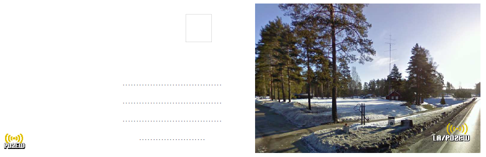 Outer card for Sorken and Morokulien 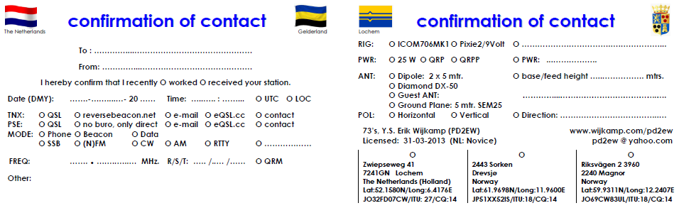 Inner card with info about station/contact/signal and location info |